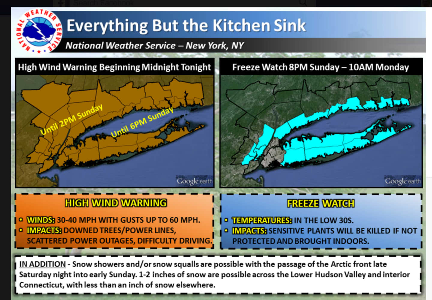
The high wind warning will be in effect until 2 p.m. Sunday. Winds will reach speeds of 30 to 40 mph, with gusts up to 60 mph.
The National Weather Service warns that trees and power lines may be downed, which may lead to scattered power outages and difficulty driving.
Snow showers and snow squalls are possible overnight Saturday into Sunday as low temperatures hover around the freezing mark with wind chill values between 25 and 30. New snow accumulation of less than half an inch is possible.
On Sunday there is a chance of snow showers before 8 a.m. The rest of the day will be partly sunny, with a high near 39. Wind chill values will be between 20 and 30. It will be very windy, with a northwest wind of 35 to 40 mph, decreasing to 28 to 33 mph in the afternoon. Wind gusts could reach as high as 55-60 mph. The chance of precipitation is 30 percent.
Sunday night there is a slight chance of snow after 2 a.m. It will be mostly cloudy, with a low around 24. Wind chill values will be between 15 and 20. The chance of precipitation is 20 percent.
Some snow is likely Monday before 11 a.m., then rain is likely. It will be cloudy, with a high near 46. The chance of precipitation is 70 percent, with new snow accumulation of around an inch possible.
Monday night, there is a chance of rain before 11 p.m., then a chance of snow. It will be mostly cloudy, with a low around 26. The chance of precipitation is 40 percent.
Click here to follow Daily Voice Scarsdale and receive free news updates.